Aerial Imaging
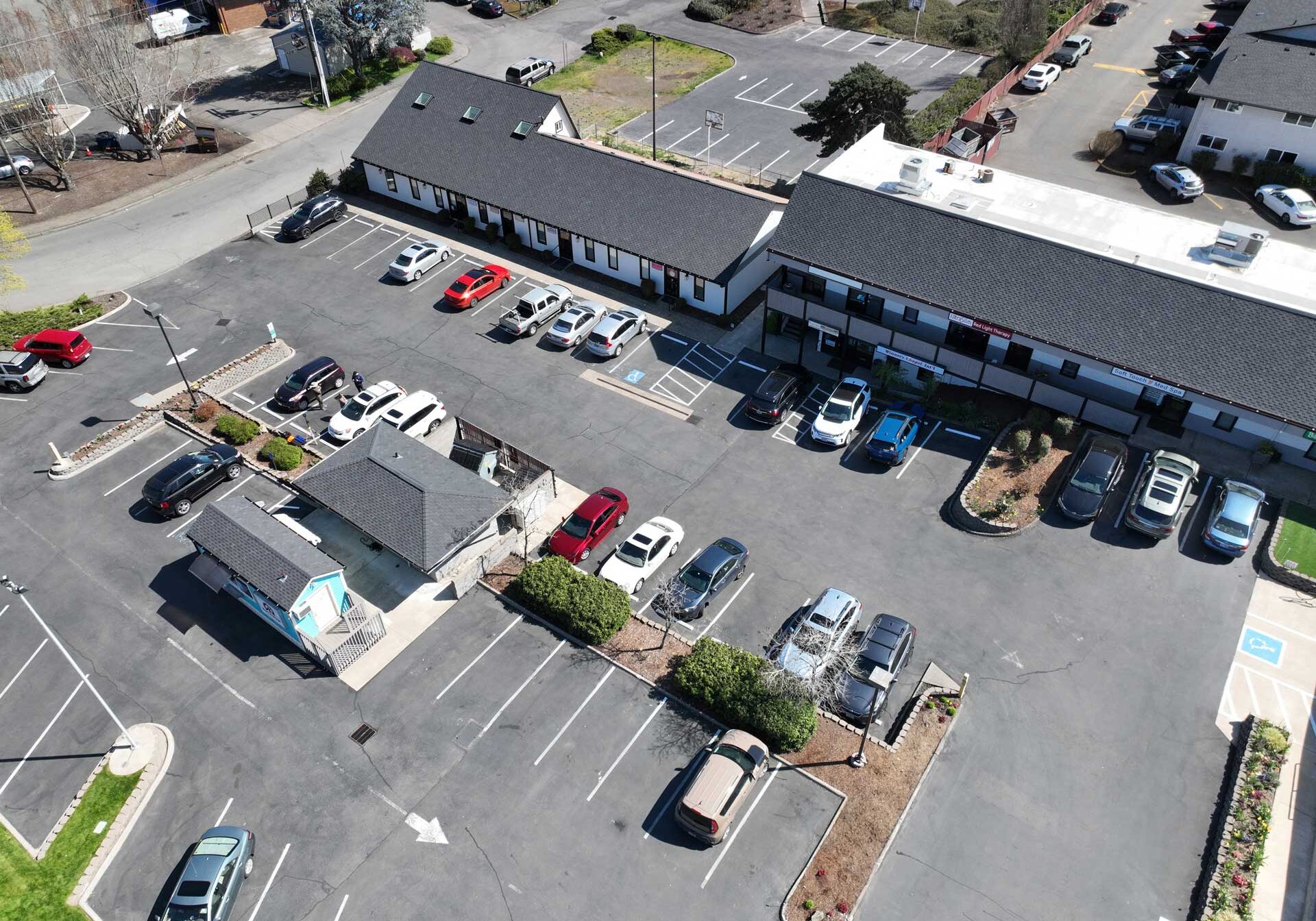
Gain a comprehensive perspective of your project with high-resolution aerial imagery and data, providing an unparalleled bird’s eye view of existing site conditions. This advanced technology allows for precise and detailed assessments, making it an invaluable tool during the preliminary planning and design phases. Whether you’re evaluating large-scale construction sites, environmental impact areas, or urban development zones, our aerial imagery offers clear and accurate visuals that help identify potential challenges and opportunities from the outset.
Incorporating high-resolution aerial imagery into your planning process streamlines decision-making and enhances project efficiency. By accessing up-to-date and precise data, you can make informed decisions that save time and resources, reducing the need for costly on-site visits and rework. This technology not only supports initial design concepts but also aids in ongoing project management, ensuring that your vision is executed flawlessly. Elevate your planning and design strategies with the unparalleled clarity and accuracy that our aerial imagery provides.


3D Modeling
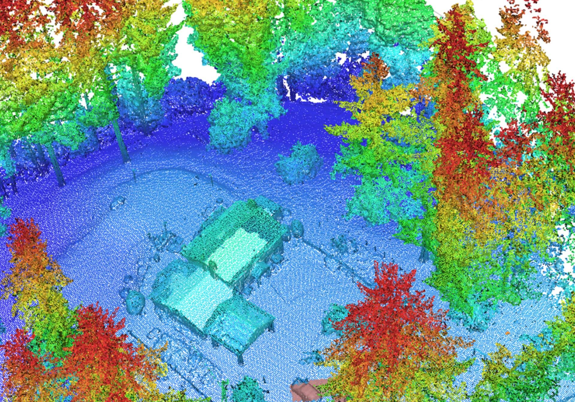
Transform the existing conditions of your site into an interactive 3D point cloud, offering unparalleled precision in planning, design, and visualization. This advanced technology allows for the accurate capture of every detail of your site, providing a comprehensive and immersive view that traditional methods simply cannot match. By converting real-world conditions into a digital 3D model, you gain a dynamic tool that enhances decision-making, streamlines workflows, and minimizes errors, ensuring that every aspect of your project is meticulously planned and executed.
An interactive 3D point cloud not only serves as a detailed reference but also as a collaborative platform for all stakeholders. This digital twin of your site enables real-time adjustments and simulations, allowing designers, architects, and engineers to visualize potential changes and their impacts before they are implemented. The result is a more efficient design process, reduced costs, and improved project outcomes. Embrace this cutting-edge solution to revolutionize your approach to site planning and design, and unlock new levels of accuracy and efficiency for your projects.
Topographic Mapping
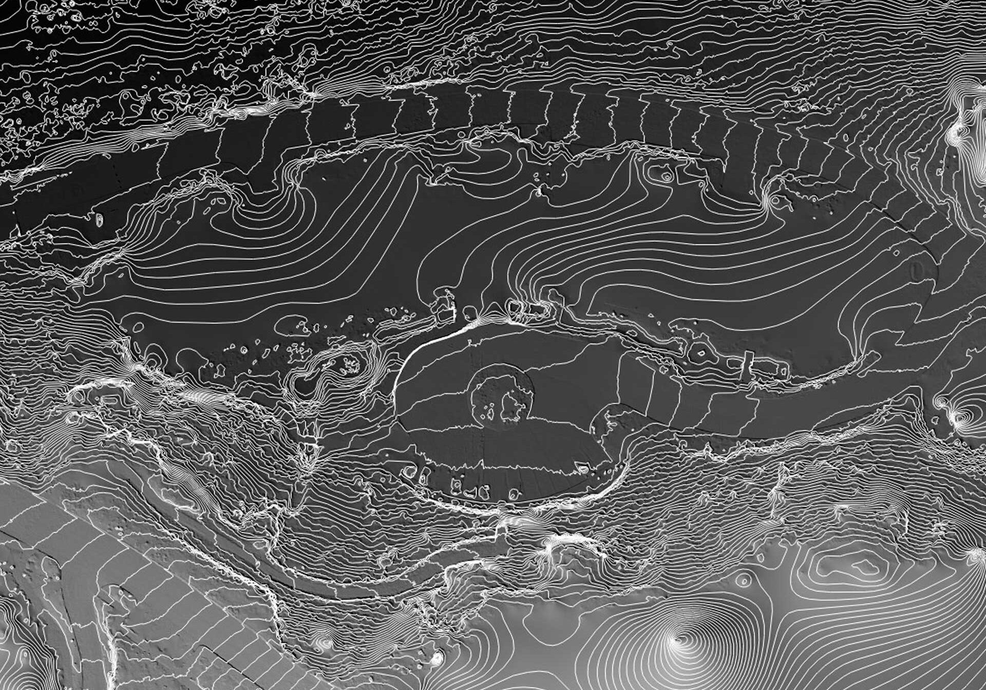
Secure precise and comprehensive topographic maps to meet your architectural and engineering needs. Accurate topographic maps provide a detailed representation of existing conditions, allowing architects and engineers to understand the lay of the land thoroughly. This understanding is crucial for designing structures that are not only aesthetically pleasing but also structurally sound and safe. With high-quality topographic maps, you can make informed decisions about site planning, grading, drainage, and construction, ensuring that every aspect of your project is well-considered and executed with precision.
Topographic maps are invaluable tools that capture the natural and man-made features of a landscape with meticulous detail. These maps facilitate better communication among project stakeholders, reducing the risk of errors and misunderstandings during the design and construction phases. By incorporating topographic maps into your workflow, you can identify potential challenges early on, such as slopes, elevation changes, and water flow patterns, allowing you to address these issues proactively. Invest in accurate topographic mapping to enhance the efficiency, accuracy, and success of your architectural and engineering projects.


Construction & Agriculture Monitoring
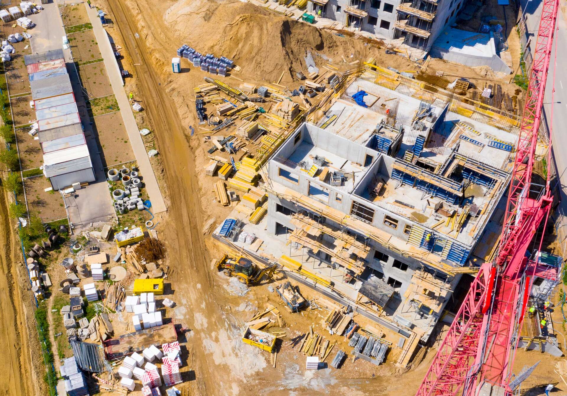
Keep your project on track with our real-time progress reports and detailed site analysis. Our comprehensive updates provide you with the latest information on existing conditions, helping you stay informed and in control every step of the way. By closely monitoring every aspect of the project, we ensure that any changes or challenges are promptly addressed, allowing you to make informed decisions quickly and efficiently.
Moreover, our detailed site analysis guarantees that your design is implemented correctly, minimizing the risk of costly errors and delays. We meticulously assess every element of the site, from structural integrity to environmental factors, to ensure that your vision is brought to life exactly as planned. With our thorough approach, you can confidently move forward, knowing that your project is being executed with precision and expertise.